Google Maps
Google Maps is a basic web mapping service application and technology provided by Google.
Share Your Favourite Spots with Family, Friends & the World ... ... in the World's most PASSIONATE MAPS COMMUNITY.
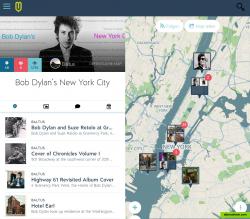
save & share your favorite spots and places via interactive maps.uebermaps is used by: travelers journalists communities cartographers event planers & organizers publishers location scouts ...
create a map, now & for free!
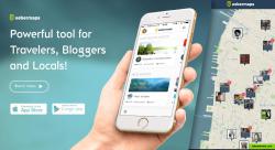
with uebermaps.com local experts are sharing local information via maps. maps have a topic or theme and contain spots and events that are pinned to a location and time. it's the best tool for publishing and sharing local information, for e.g. travelers, communities and their members, organizers, journalists, bloggers, media & news agencies, ...
Official Website
Twitter
Facebook
Collaborative writing Location Mapping Embeddable Social media integration Travel guide Interactive map
Productivity Developer Tools Social Travel and Location
collaborative-writing events social-network maps location-mapping embeddable social-media-integration map-online mapmaker map-editor travel-guide travel-planner interactive-map map-api places spots trips
Google Maps is a basic web mapping service application and technology provided by Google.
Free Android iPhone Android Tablet iPad Chrome OS Web Blackberry Apple Watch
Google Earth lets you fly anywhere on Earth to view satellite imagery, maps, terrain, 3D buildings, from galaxies in outer space to the canyons of the ocean.
Free Personal Mac OS X Windows Linux Android iPhone Android Tablet BSD iPad
OpenStreetMap (OSM) is a collaborative project to create a free editable map of the world.
Free Open Source Web
Badger enables the sales team to manage their territory by combining Google Maps, data from the CRM, schedule planning, route optimization, and lead generation on the sales person’s mobile device.
Commercial Android iPhone Android Tablet iPad Web
Yandex.Maps gives you access to maps of over 1800 cities and towns right in your pocket. Find addresses and companies. Plan your journeys in a car or on public transport taking current traffic conditions into account.
Free Android iPhone Android Tablet iPad Web Blackberry Windows Phone Telegram
2GIS provides 3D-maps of 180+ cities, contacts of 1.5 million companies, car routing and public transport routes and and more! 2GIS is a complete and up-to-date directory of organizations with detailed cities’ maps.
Free Windows Android iPhone Android Tablet iPad Web Kindle Fire Blackberry
Maps gives you turn-by-turn spoken directions, interactive 3D views, and Flyover. All in a vector-based interface that scales and zooms with ease.
Free Mac OS X iPhone iPad Apple Watch


