Google Maps
Google Maps is a basic web mapping service application and technology provided by Google.
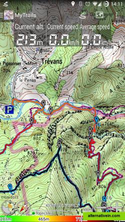
Offline trail maps for Android (and online too!) Full-screen trail map oriented with the built-in compass Know exactly which direction you are going Uncluttered map area, with unobtrusive controls and a traditional scale with track...
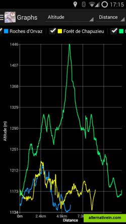
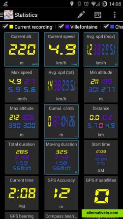
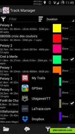
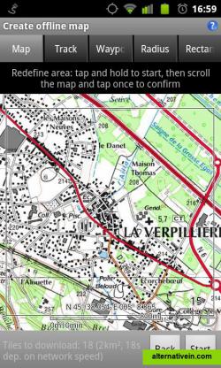
offline trail maps for android (and online too!)fullscreen trail map oriented with the builtin compassknow exactly which direction you are goinguncluttered map area, with unobtrusive controls and a traditional scale with track duration and distancerecord gps tracksvisualize your track at any time and analyse your course during or after the outdoor activitydisplay multiple gps tracks at oncevisualize your previous outings and those uploaded to gps community sites, so you always pick a great trailcolorized tracksvisualize the key indicators of the track (altitude, speed, rate of ascent, slope, gps accuracy) right on the map with a detailed legendopengl renderingaccelerated map drawing, allows smooth and snappy display even with tens of thousands of track pointskinetic scrolling, pinch zoominghave fun exploring and interacting with the mapoffline mapssave battery and data chargesthe map displays instantaneouslyoptionally falls back to online for noncovered areasoffline map creationno need to use desktopbased tools to create offline maps, you can do it in mytrails, in the backgroundpause and resume the tile downloaddownload on wifi only to save data charges, or go wildonline mapspick from many builtin online map sources (openstreetmap, yahoo, bing and many other global and local providers)add more map sources using the editable flexible url providergestureseasily switch between active maps by swiping three fingers left to right in the map view.pull down the hud with information on your speed and altitude by swiping three fingers down your screensave and load gpx filesdisplay your previous tracks in mytrails, geocode your pictures, use the tracks on the web or your computermgm for offline mapscreate your own mgm packs based on existing tools and efficiently store multiple zoom levels and different maps formats
Productivity Developer Tools Games Travel and Location Sport and Health
gps map-online offline-maps sports cycling gps-navigation gps-maps hiking
Google Maps is a basic web mapping service application and technology provided by Google.
Free Android iPhone Android Tablet iPad Chrome OS Web Blackberry Apple Watch
Zombies, Run! is an ultra-immersive running game and audio adventure, co-created with award-winning novelist Naomi Alderman.
Freemium Android iPhone Apple Watch
Maps gives you turn-by-turn spoken directions, interactive 3D views, and Flyover. All in a vector-based interface that scales and zooms with ease.
Free Mac OS X iPhone iPad Apple Watch
Modest Maps is a small, extensible, and free library for designers and developers who want to use interactive maps in their own projects.
Free Open Source Mac OS X Windows Linux
TransforMap works towards an online platform for you to visualize the myriads of alternatives to the dominant economic thinking on a single mapping system.
Free Open Source Web
TRACK, SHARE, EXPLORE... Blaze your own trail with EveryTrail! Track your trips, take photos and add your story. Then share it all with one click at EveryTrail.com, Facebook and Twitter. Available for: iPhone & Android: http://www .
Freemium Android iPhone Web Blackberry Windows Mobile
Geo Tracker is fast and simple software for recording your gps tracks. If you're a fan of action sports and long distance travel - this app is for you!.
Freemium Android Android Tablet
Visualize your local tech startup community on a custom Google Map. Host everything locally on your own server, or optionally show data from Startup Genome. .
Free Open Source Self-Hosted
Turn your Android phone into a powerful utility with sports training Sport Trainer application It even lets you select the perfect soundtrack for your workout .
Free Android Android Tablet
Mobile GMaps displays maps from Yahoo! Maps, Windows Live Local (MSN Virtual Earth), Ask.com, Open Street Map and other sources. MGMaps can connect to a GPS receiver over bluetooth or use internal GPS features.
Free Personal Java Mobile
Waypointer is a service for POI (GPS coordinates) search and management. It will be useful for tourists and owners of GPS devices. With help of Waypointer you can find POIs on map filtered by categories (i.e.
Free Web
Designed to run smoothly on devices with limited memory and on unreliable networks.
Free Android

