Google Earth
Google Earth lets you fly anywhere on Earth to view satellite imagery, maps, terrain, 3D buildings, from galaxies in outer space to the canyons of the ocean.
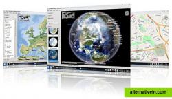
Marble is a Virtual Globe and World Atlas that you can use to learn more about Earth: You can pan and zoom around and you can look up places and roads. A mouse click on a place label will provide the respective Wikipedia article.
Marble is a Virtual Globe and World Atlas that you can use to learn more about Earth: You can pan and zoom around and you can look up places and roads. A mouse click on a place label will provide the respective Wikipedia article.
Portable Offline maps Turn by turn navigation
Productivity Developer Tools Travel and Location
portable maps map-viewer offline-maps turn-by-turn planetarium satellite
Google Earth lets you fly anywhere on Earth to view satellite imagery, maps, terrain, 3D buildings, from galaxies in outer space to the canyons of the ocean.
Free Personal Mac OS X Windows Linux Android iPhone Android Tablet BSD iPad
World Wind lets you zoom from satellite altitude into any place on Earth.
Free Open Source Mac OS X Windows Linux
Site that lets you compare the satellite imagery offered by NASA, Yahoo Maps, Microsoft Virtual Earth and more.
Free Web
This program allows work with any maps service if you can describe getting picture by longitude/latitude(if you want you can write config file or simplepascal script to describe how obtain needle photos).
Free Windows
EarthBrowser is an innovative earth simulation that combines an easy to navigate 3 dimensional globe with real-time weather conditions and 7 day forecasts for thousands of locations worldwide.
Commercial Mac OS X Windows
TerraExplorer is a powerful, easy to use tool to build, analyze, and navigate high resolution 3D world environments created by fusing aerial and satellite photography...
Freemium Windows Android iPhone Web Windows Mobile
Earth View is a collection of the most beautiful and striking landscapes found in Google Earth.
Free Windows Chrome

