OpenGeo Suite
OpenGeo provides support and services around GeoServer, OpenLayers, PostGIS, GeoWebCache, and GeoExt. The OpenGeo Suite brings together the OpenGeo Architecture into a...
uDig is a GIS software program produced by a community led by Canadian-based consulting company Refractions Research. It is based on the Eclipse platform and features full layered open source GIS.
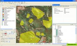
uDig is a GIS software program produced by a community led by Canadianbased consulting company Refractions Research. It is based on the Eclipse platform and features full layered open source GIS. It is written in Java and released under GNU Lesser General Public License.
Productivity Developer Tools Business and Commerce Travel and Location
maps mapping gis geographic spatial
OpenGeo provides support and services around GeoServer, OpenLayers, PostGIS, GeoWebCache, and GeoExt. The OpenGeo Suite brings together the OpenGeo Architecture into a...
Free Open Source Mac OS X Windows Linux
MapWindow is a fully free and open source geographic information system project. It includes an open source programming component, MapWinGIS ActiveX, and an extensible...
Free Open Source Windows
Global Mapper is a GIS Data processing application that offers access to a variety of spatial datasets and provides GIS functionality. Global Mapper is a must-have...
Commercial Windows
Intergraph is the leading global provider of engineering and geospatial software that enables customers to visualize complex data. Businesses and governments in more...
Commercial Windows
The Map Kit framework provides an interface for embedding maps directly into your own windows and views. This framework also provides support for annotating the map...
Freemium Web
OpenJUMP is an open source Geographic Information System (GIS) written in the Java programming language. It is developed and maintained by a group of volunteers from...
Free Open Source Mac OS X Windows Linux

