Graphhopper
A fast driving directions API with world wide coverage. Based on open source software and OpenStreetMap. Stay independent and flexible.
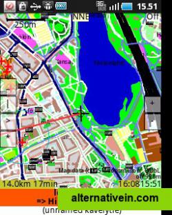
ShareNav is a navigation & (vector) map viewing program with OpenStreetMap editing capabilities. It also has support for viewing raster maps.
sharenav is a navigation & (vector) map viewing program with openstreetmap editing capabilities. it also has support for viewing raster maps. sharenav has audio guidance in english, german and finnish and navigation for car, bicycle and foot.
sharenav installed from the store has a bundled map for a region around helsinki, finland. more maps can be created from openstreetmap data. sharenav can also read maps created for gpsmid.
map viewing & navigation features include:
* view vector map, optionally rotated by compass or movement* navigation by foot, bicycle or car, voice & text guidance* optionally show raster tile map as background map (with vector map as overlay) or in a separate window* overspeed watch: alert for exceeding speed limit of way* show estimated time of arrival
map editing & creation features include:
* record tracks* edit osm data: way tags, adding pois, editing poi tags* upload tracks to osm
sharenav feels best at home on android, but most of the functions also work on j2me and the desktop or laptop.
Offline maps Based on OpenStreetMap User generated Turn by turn navigation
Discontinued maps gps map-online offline-maps openstreetmap user-generated gps-navigation navigation turn-by-turn maps-navigation-trips
A fast driving directions API with world wide coverage. Based on open source software and OpenStreetMap. Stay independent and flexible.
Free Open Source Windows Linux Android Web Self-Hosted
Magic Earth is a free turn-by-turn navigation app with downloadable maps and speed cameras alerts. • OpenStreetMap. Will do to maps what Wikipedia did to encyclopedia. • Free Turn-by-Turn Navigation.
Free Android iPhone Android Tablet iPad
Scout is the only app that lets you chat, plan Meet Ups, share your ETA and get turn-by-turn GPS voice directions. Now you can navigate, coordinate and communicate without the hassle of multiple apps.
Freemium Android iPhone Web Windows Phone Apple Watch
TRACK, SHARE, EXPLORE... Blaze your own trail with EveryTrail! Track your trips, take photos and add your story. Then share it all with one click at EveryTrail.com, Facebook and Twitter. Available for: iPhone & Android: http://www .
Freemium Android iPhone Web Blackberry Windows Mobile
Maps is your guide to everywhere. Find your way with voice navigation and turn-by-turn driving, transit, and walking directions. Search for places to get directions, business info, and reviews. Download maps to use when you’re offline.
Free Windows Windows RT Windows Phone
Mobile Trail Explorer is an application where user can view and record tracks using the mobile phone and GPS device (either external or internal).
Free Open Source Java Mobile
Chart your own course with built-in GPS (Global Positioning System) featured in selected BlackBerry smartphones. Pin-point your geographic location, even as your position shifts and changes.
Free Blackberry
Bt747 allows for configuring MTK/MTK2 based GPS data loggers (GPS trackers) and downloading track data (GPS logs) to your PC. It can convert and export logs to various formats, geo-tag pictures and upload A-GPS data to the GPS device.
Free Open Source Mac OS X Windows Linux Blackberry Windows Mobile Java Mobile
Turn-by-turn voice driving navigation with a choice of Google, Bing and MapQuest maps.
Freemium Windows Phone
Mobile GMaps displays maps from Yahoo! Maps, Windows Live Local (MSN Virtual Earth), Ask.com, Open Street Map and other sources. MGMaps can connect to a GPS receiver over bluetooth or use internal GPS features.
Free Personal Java Mobile

