QLandkarte GT
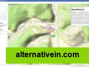
QLandkarte GT is a powerful Open Source GIS application to display your GPS data on a variety of maps.
- Free
- Open Source
- Mac OS X
- Windows
- Linux
QLandkarte GT is a powerful Open Source GIS application to display your GPS data on a variety of maps. It's target is the less the scientific user but the private outdoor aficionadoIt can be used for managing waypoints, routes, tracks and maps, and transferring them to a GPS device.
Links to official QLandkarte GT sites
Features
Offline maps Based on OpenStreetMap
Categories
Productivity Travel and Location
Tags
maps gps offline-maps openstreetmap gis garmin