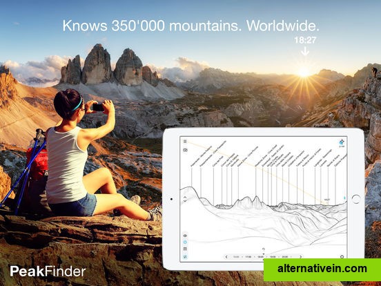
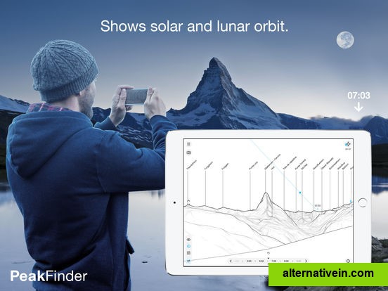
Explore more mountains than any mountaineer! PeakFinder Earth makes it possible… and shows the names of all mountains and peaks with a 360° panorama display. This functions completely offline - and worldwide!.
Commercial
works offline and worldwide includes more than 350'000 peak names overlays the camera image with the panorama drawing realtime rendering of the surrounding landscapes in a range of 300km/200mil digital telescope to select less prominent peaks 'show me'function for visible peaks selection of the viewpoint by gps, the peak directory or an (online) map can fly like a bird from peak to peak and vertically upwards shows the solar and lunar orbit with rise and set times uses compass and motion sensors weekly updates of the peak directory
AT&T Navigator transforms your smartphone into a voice-guided GPS navigation system, with turn-by-turn driving directions, traffic alerts, automatic rerouting, gas price search, and regular map updates. A subscription charge of $9.
Alternativein is a new approach to finding good application.
Just type what software you want to change and browse great alternatives,
based on our great community recommendations.


 0 Like