Google Maps
Google Maps is a basic web mapping service application and technology provided by Google.
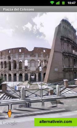
With Street View you can explore the world at street level. Explore world landmarks, discover natural wonders, and step inside locations such as museums, arenas, restaurants, and small businesses with Google Street View.
with street view you can explore the world at street level.
explore world landmarks, discover natural wonders, and step inside locations such as museums, arenas, restaurants, and small businesses with google street view.also create photo spheres to add your own street view experiences. start with your phone’s camera or add a one–shot spherical camera (like the ricoh theta s) for easy 360º photography. then, you can publish to google maps to share your photo spheres with the world.
Productivity Developer Tools Travel and Location
maps street-map navigation spherical-photos
Google Maps is a basic web mapping service application and technology provided by Google.
Free Android iPhone Android Tablet iPad Chrome OS Web Blackberry Apple Watch
Google Earth lets you fly anywhere on Earth to view satellite imagery, maps, terrain, 3D buildings, from galaxies in outer space to the canyons of the ocean.
Free Personal Mac OS X Windows Linux Android iPhone Android Tablet BSD iPad
Yandex.Maps gives you access to maps of over 1800 cities and towns right in your pocket. Find addresses and companies. Plan your journeys in a car or on public transport taking current traffic conditions into account.
Free Android iPhone Android Tablet iPad Web Blackberry Windows Phone Telegram
Maps gives you turn-by-turn spoken directions, interactive 3D views, and Flyover. All in a vector-based interface that scales and zooms with ease.
Free Mac OS X iPhone iPad Apple Watch
Modest Maps is a small, extensible, and free library for designers and developers who want to use interactive maps in their own projects.
Free Open Source Mac OS X Windows Linux
TransforMap works towards an online platform for you to visualize the myriads of alternatives to the dominant economic thinking on a single mapping system.
Free Open Source Web
GPS Navigation & Maps - Scout offers the proven quality of million-seller GPS Navigation.
Freemium Android iPhone Android Tablet iPad
This program allows work with any maps service if you can describe getting picture by longitude/latitude(if you want you can write config file or simplepascal script to describe how obtain needle photos).
Free Windows
OpenStreetCam - the crowd sourced, free and open street level imagery platform for OpenStreetMap.
Free Open Source Android iPhone Web Self-Hosted JavaScript OpenStreetMap Leaflet
To view maps in 3D, and tour and save collections to video, install 3D
Free Windows


