MapWindow GIS
MapWindow is a fully free and open source geographic information system project. It includes an open source programming component, MapWinGIS ActiveX, and an extensible...
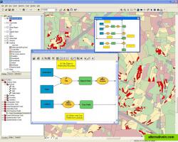
ArcGIS is geographic information system (GIS) software for visualizing, managing, creating, and analyzing geographic data.
ArcGIS is geographic information system (GIS) software for visualizing, managing, creating, and analyzing geographic data. Using ArcGIS, you can understand the geographic context of your data, allowing you to see relationships and identify patterns in new ways.
The ArcGIS Desktop program has 3 different lincense options: ArcView, ArcEditor and ArcInfo. ArcInfo beeing the biggest.
Official Website
Facebook
Twitter
Built in editor Interactive map
Productivity Developer Tools Business and Commerce Travel and Location
free-storage maps built-in-editor mapping interactive-map gis geographic cartography spatial
MapWindow is a fully free and open source geographic information system project. It includes an open source programming component, MapWinGIS ActiveX, and an extensible...
Free Open Source Windows
Global Mapper is a GIS Data processing application that offers access to a variety of spatial datasets and provides GIS functionality. Global Mapper is a must-have...
Commercial Windows
Intergraph is the leading global provider of engineering and geospatial software that enables customers to visualize complex data. Businesses and governments in more...
Commercial Windows
Blue Spatial is an ESRI Geoservices REST Implementation. Blue Spatial is a drop in replacement for ArcGIS Server that works with all ESRI API's and ArcGIS Desktop....
Commercial Windows
OpenJUMP is an open source Geographic Information System (GIS) written in the Java programming language. It is developed and maintained by a group of volunteers from...
Free Open Source Mac OS X Windows Linux
professional desktop gis supporting most http://alternativein .
Commercial Windows

